Latest News
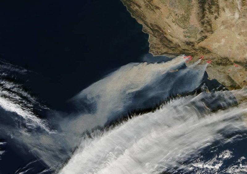
Thick layers of smoke and ash still hover over the Los Angeles metropolitan area Monday as fire crews continue to defend against the wildfires that have raged on the West coast for more than a week. According to the Los Angeles Times, the blaze had scorched more than 230,000 acres by Sunday evening. Authorities are urging residents in Santa Barbara county to evacuate as the fire rushes toward new areas of dry vegetation, hurried along by a combination of low humidity and the gusting Santa Ana winds. Much like during the wine country fires in October, satellite images have proved useful in monitoring the extent of the fire’s reach.
1) U.S. astronaut Randy Bresnik shares his perspective from the International Space Station (ISS).
Today’s pass over SoCal unfortunately doesn’t look any better. The fires east of Camp Pendleton and in Baja are visible as well. #CaliforniaWildfires pic.twitter.com/khM9TK1u0F
— Randy Bresnik (@AstroKomrade) December 7, 2017
2) Air quality in nearby regions has plunged due to the massive amounts of smoke the wildfires are producing, as seen in these Sentinel 2 photos captured by the European Space Agency (ESA).
#Sentinel2 views of the #CaliforniaWildfire, huge amounts of smoke being produced. Fires are the immediate problem, but the effects of air pollution can be long-lasting. pic.twitter.com/RADgqjgYuZ
— Simon Proud (@simon_rp84) December 7, 2017
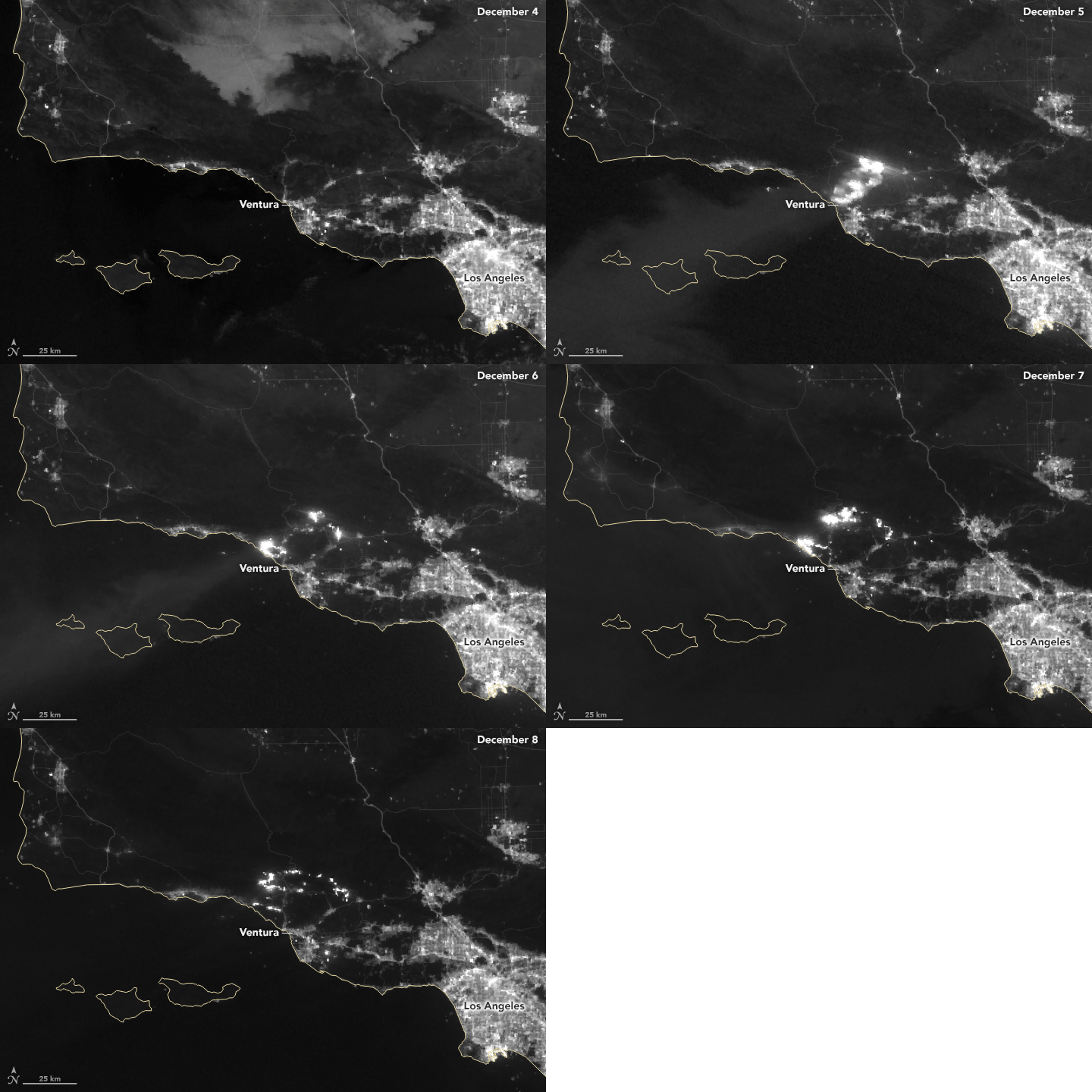
3) Captured by NASA‘s Suomi National Polar-orbiting Partnership (Suomi NPP) satellite, this time lapse shows how quickly the front of the Thomas fire spread outward between Dec. 4 and Dec. 8.
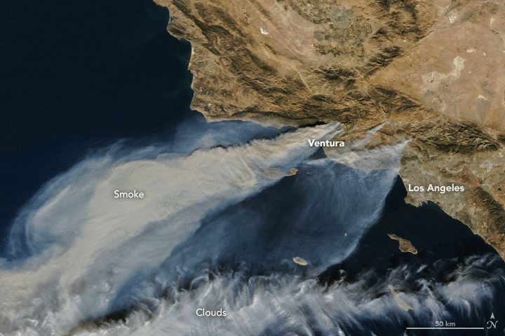
4) The Moderate Resolution Imaging Spectroradiometer (MODIS) on NASA’s Terra satellite acquired this natural-color image in the afternoon on Dec. 5, 2017.
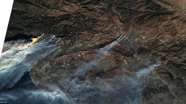
5) Satellite processor Pierre Markuse published these natural color images captured by ESA’s Sentinel 3 satellite.
6) NASA’s Aqua satellite captured this natural color image revealing actively burning areas detected by MODIS’ thermal bands.
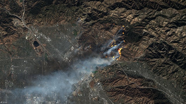
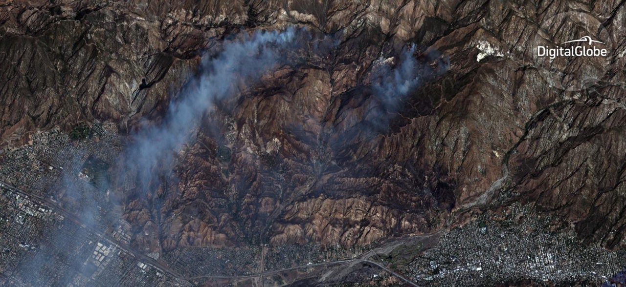
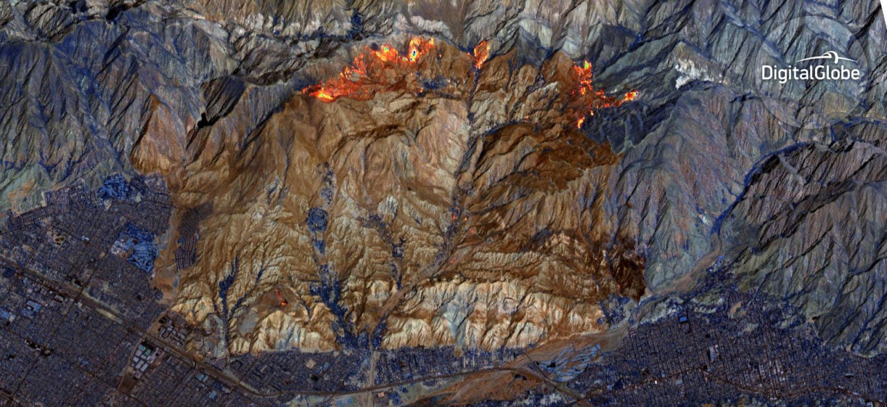
7) These images, taken by DigitalGlobe’s Worldview 3 satellite, show fires burning in the mountains east of San Fernando, both in natural color, with smoke visible, and Shortwave Infrared (SWIR), which is smoke-free.
Get the latest Via Satellite news!
Subscribe Now