Latest News

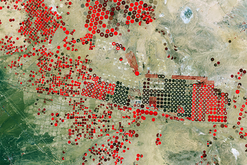
Satellite imagery of agricultural structures near Hail, Saudi Arabia. Brighter reds indicate more photosynthetically active vegetation. Photo: Deimos Imaging.
UrtheCast and its subsidiary Deimos Imaging announced a broad partnership with Esri, starting with a new UrtheCast imagery service which is powered by Esri: Kanvas. The service will enable all Esri users to access Deimos imagery directly into their apps and desktops. The imagery service curated by Deimos Imaging is a precursor to the upcoming UrtheDaily constellation, which is expected to image the entire Earth daily at 5m resolution, complementing Sentinel 2 and Landsat applications.
For three months, anyone with Esri’s ArcGIS platform will have free access to the multi-season time series of medium and very-high resolution satellite imagery, over the whole of Spain and California. Hosted in Amazon Web Services using ArcGIS, Esri users can use the multi-temporal imagery service and start building apps for monitoring, change detection, precision insights and more.
Esri also announced that DigitalGlobe has selected its ArcGIS 10.5 Enterprise architecture to deliver a new subscription product offering, Imagery+Analytics, that enables organizations to subscribe to high-resolution imagery and analytics directly within their Esri environment and tools.
The Imagery+Analytics subscription leverages Esri’s ArcGIS Image Server to let customers search, access, and analyze vast amounts of DigitalGlobe high-resolution imagery to find the data that suits their needs and then access it directly as a dynamic web layer within their enterprise for viewing or analysis.
Once an area of interest is identified using the Imagery+Analytics application, Image Server displays the browse-level imagery and metadata so customers can add the imagery to their subscription. The multispectral and temporal imagery then becomes accessible as dynamic image services running in the cloud, for both viewing and analysis within the ArcGIS applications. Users also have access to a wide range of cloud-based analyses using ArcGIS raster analytics as well as DigitalGlobe’s GBDX Platform, which includes analysis capabilities powered by Harris Geospatial’s Envi suite and deep learning-powered capabilities like those offered by CrowdAI and other ecosystem partners.
Get the latest Via Satellite news!
Subscribe Now