Latest News
UrtheCast’s Deimos 1 Satellite Now Providing Monthly Cloud-Free Data of the Contiguous United States
[Via Satellite 05-06-2016] Newly collected imagery from UrtheCast’s Deimos 1 satellite is now flowing to its online platform, known as the UrthePlatform. The company anticipates that it will be able to provide this broad-area-coverage Deimos 1 data cloud-free for the entire contiguous United States every month throughout the 2016 agricultural growing season. This data will be available for extraction, on demand, from the UrthePlatform Application Programming Interfaces (APIs) in GeoTIFF format.
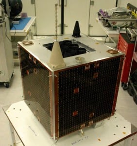
UrtheCast gained the Deimos 1 and 2 satellites through its acquisition of Deimos Imaging in July 2015. Deimos 1 has a wide imaging swath of 650 km, along with a high revisit rate. The new supply of Deimos 1 data complements an already-existing five-year archive of data from the satellite in the contiguous U.S. and forms part of UrtheCast’s growing suite of medium-resolution sensors and datasets.
In the coming months, UrtheCast expects to add further data from its own spacecraft as well as data from third-party providers to the UrthePlatform, with the objective of providing an increasingly powerful capability for geoanalytics applications and markets.
Get the latest Via Satellite news!
Subscribe Now