Latest News
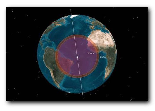
View of an exactEarth AIS Satellte at 400 mile altitue (purple) and 530 mile altitude (red). Photo: exactEarth
[Via Satellite 04-17-2014] ExactEarth and SRT have partnered to develop a new technology called ABSEA to enable global tracking for low-power Automatic Identification System (AIS) transceivers aboard small commercial and leisure vessels.
AIS is a Very High Frequency (VHF) technology designed for terrestrial-based tracking with a range that is usually limited to about 50 nautical miles. Class A transceivers can typically be tracked globally from the exactEarth AIS network; however, Class B transceivers cannot be accurately tracked from space at the present moment.
Since May 2013, the two companies have been working together to develop ABSEA, which allows standard low-powered AIS transmissions to be received by exactEarth satellites. This enables small vessels fitted with the new technology to have a wider area of tracking capability. Under the agreement, SRT and exactEarth jointly own the new technology and will commercialize the tracking data together.
Get the latest Via Satellite news!
Subscribe Now