Latest News
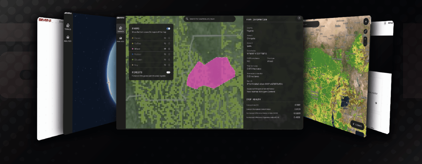
Amini releases Lite data product. Photo: Amini
Amini has unveiled details of a key new product launch as it looks to bring the power of satellite tech to its customers, mainly farmers across Africa. It is launching Amini Lite, a lightweight version of the Amini Platform designed to make critical geospatial datapoints on Africa and the Global South quickly and easily accessible to data analysts, developers, and growing businesses. Amini announced the new launch Sept. 23.
Amini aims to make a difference in Africa and the development of African data infrastructure by launching a series of IoT-integrated nanosatellites that could have a huge impact for farmers across Africa. CEO Kate Kallot said in an interview with Via Satellite last year, “We are not building technology, and then applying it to Africa, we are building technology that is designed specifically for Africa.”
The company says this launch provides something directly to developers and data analysts, especially those looking to quickly integrate highly technical datasets (e.g., geospatial data from satellite imagery or remote sensing) without the pain of working with specialist geospatial tools. The company says ‘Amini Lite’ is a return to its roots. It sees itself as developers and engineers who want to build noteworthy tools for other developers.
The platform aims to give customers access to data to make life simpler, whether they need it to be granular down to a pixel or aggregated for region-level analysis. Amini aims to provide richer data for better decision making. Amini Lite enables customers to layer various data points on their area of interest around crop health, water stress and more critical information for environmental and climate analysis.
Get the latest Via Satellite news!
Subscribe Now