Latest News

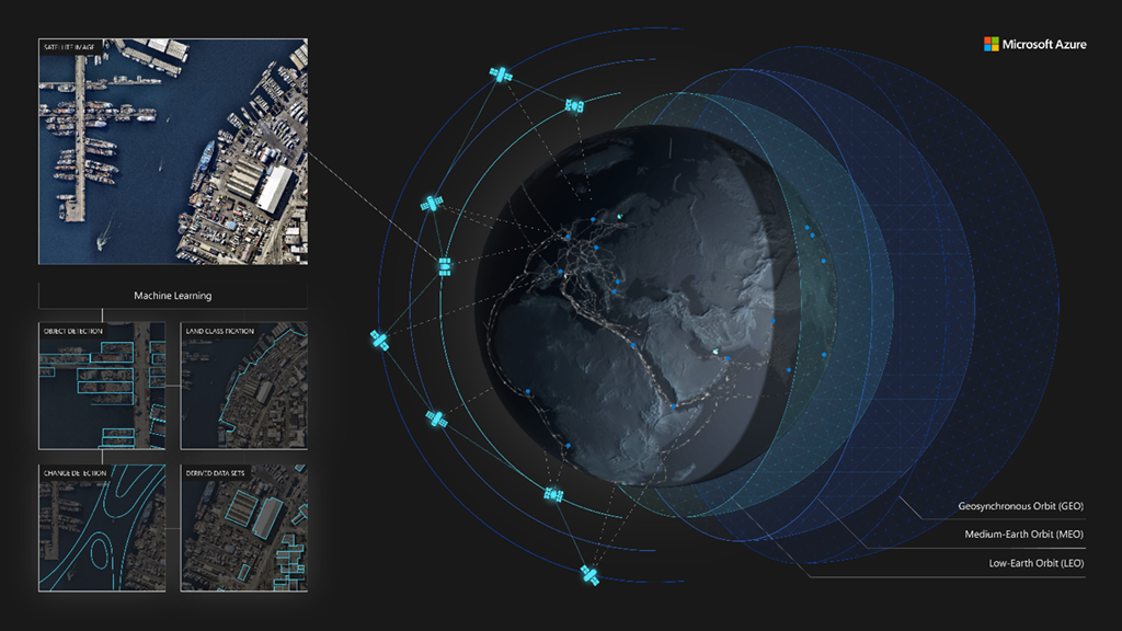
Azure Space ecosystem showing multi-orbits and geospatial capabilities through Machine Learning. Photo: Microsoft
Microsoft is expanding its ecosystem and tools for the space community, Azure Space, with new industry partners and capabilities. On Dec. 9, Microsoft announced new and expanded partnerships with Airbus, ST Engineering iDirect, Esri, Blackshark.ai, and Orbital Insight.
Microsoft is making Airbus premium satellite imagery and elevation data available in its Microsoft Azure Maps, which is a collection of geospatial services and software development kits (SDKs). Airbus has agreed to feed Azure Maps with its SPOT, Pléiades, and Pléiades Neo satellite imagery and WorldDEM4Ortho elevation data.
“The extensive Azure Maps user base, who is eager for accurate and top-quality imagery, will be able to rely on Airbus’ premium data services to develop new applications and turn their innovative ideas into reality,” said François Lombard, director of the Intelligence business at Airbus Defence and Space.
Microsoft announced three other geospatial partnerships, with Esri, Blackshark.ai, and Orbital Insight. Esri has agreed to bring ArcGIS Image to Azure customers for end-to-end geospatial data management and analytics. Blackshark.ai will offer its advanced geospatial intelligence and 3D synthetic environments, and Orbital Insight will make the Orbital Insight GO platform available on Microsoft Azure.
In addition, the Azure Orbital tool is now previewing a service for ground stations. It includes support for Microsoft and KSAT‘s KSATlite ground stations. Starting this month, customers can use Azure Orbital APIs or the Azure Portal to communicate with their satellites using Microsoft and KSAT antennas. This network will expand next year with support for ground station partners Viasat and USEI.
Microsoft has also added ST Engineering iDirect as an Azure Orbital ground segment partner. The companies will bring ST Engineering iDirect’s satcom solutions to Azure as virtualized modems for Azure Orbital customers.
Get the latest Via Satellite news!
Subscribe Now