Latest News

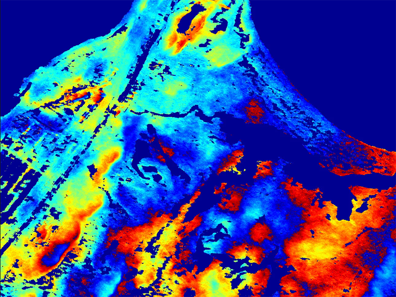
Photo: ICEYE
ICEYE has demonstrated interferometric capabilities from Synthetic Aperture Radar (SAR) satellites under 100 kg in mass, saying it is the first to do so. With an actively maintained 18-day ground track revisit cycle, ICEYE said it can now produce a capability that was previously only available from larger, conventional SAR satellites. Interferometry will be made available to ICEYE customers later in 2020.
SAR interferometry is used to detect millimeter-scale surface movements in vertical direction between two or more SAR images. These height differences are analyzed using maps called interferograms, which are the basis for creating Digital Elevation Models (DEM). Interferograms are also used for monitoring oil exploration activities, ongoing underground constructions, ensuring the safety of mining activities, and analyzing ground deformations after earthquakes, among other uses.
[Read more: Iceye CEO Looks to Solve Problems With SAR Data]
“Interferometry can only be performed with data from SAR satellites that are maintained in a very precise orbit,” said Pekka Laurila, CSO and co-founder of ICEYE. “The now-demonstrated 18-day repeat orbit highlights the maneuverability of ICEYE’s satellite constellation, which allows us to produce new high-precision data types for our customers.”
Get the latest Via Satellite news!
Subscribe Now