Latest News

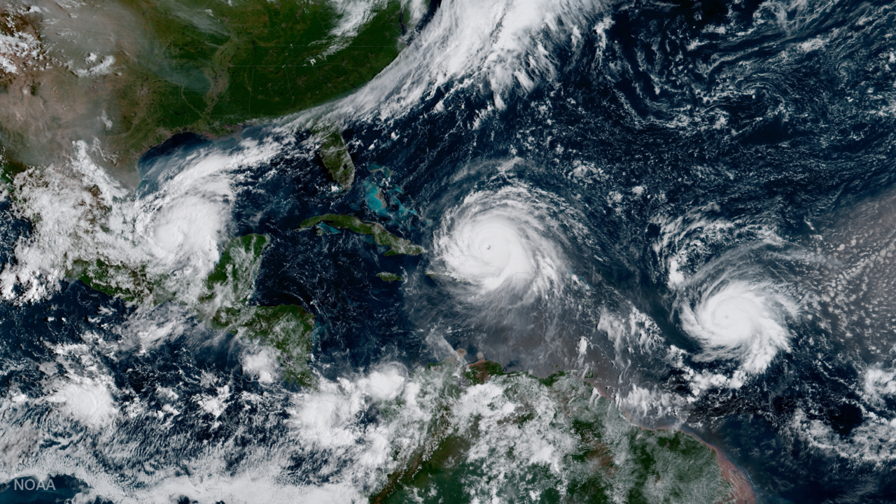
GOES 16 captured this image of three Atlantic hurricanes simultaneously: Katia (L), Irma (M), and Jose (R). Photo: NOAA.
The 2017 Atlantic hurricane season has produced some of the most intense weather events seen in generations. Amidst the destruction, NOAA’s new GOES 16 weather satellite has proved to be a vital addition to weather forecasting infrastructure, as demonstrated when Puerto Rico lost its land-based weather forecasting radar ahead of Hurricane Maria. GOES 16, part of NOAA’s Geostationary Operational Environmental Satellite system, will become fully operational in November.
Get the latest Via Satellite news!
Subscribe Now