Latest News

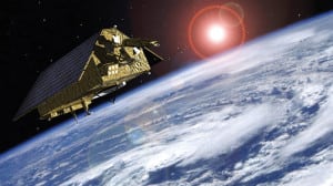
Artist rendition of Sentinel 6, which carries a radar altimeter to provide high-precision and timely observations of the topography of the global ocean. Photo: ESA 2015, Airbus Defence and Space.
[Via Satellite 05-11-2015] The European Space Agency (ESA) and Airbus Defence and Space have signed a 177 million euros development and production contract for the Jason CS/Sentinel 6 satellite. Jason CS/Sentinel 6 is a mission to carry out high-precision measurements of ocean surface topography. The implementation of the second satellite will follow the approval of the program by Eumetsat’s council in June and it is co-funded by Eumetsat and by the European Union via the Copernicus program.
The satellites will measure their distance to the oceans’ surfaces with an accuracy of a few centimeters and use this data to map it globally, repeating the cycle every 10 days. The measurements made are vital for modeling the oceans and predicting rises in sea levels. This data will also be used increasingly for weather forecasts and storm surge warnings.
Get the latest Via Satellite news!
Subscribe Now