Latest News

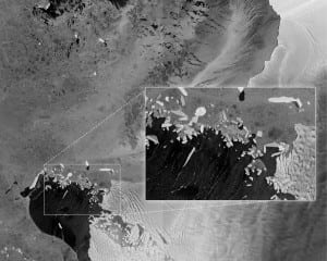
This image shows the extent of flooding in the Caprivi plain from the Zambezi River in Namibia. Sentinel 1A acquired this image in its main ‘Interferometric Wide Swath’ mode with a swath width of 250 km and in dual polarization. Photo: ESA
[Via Satellite 04-22-2014] The European Space Agency (ESA) has received the first radar images from Sentinel 1A. The images were captured the day after launch, and though not calibrated, serve to demonstrate the capabilities of the satellite.
Sentinel 1A will be used by the European Commission as part of the Copernicus environmental monitoring program for a variety of applications including urban planning, agricultural monitoring and mapping deforestation. The satellite has the ability to see through clouds, rain and night using its radar instruments.
Sentinel 1A is not yet in its operational orbit. The commissioning phase, which includes moving the satellite as well as calibrating instruments, is expected to take roughly three months.
Get the latest Via Satellite news!
Subscribe Now