Latest News
[Via Satellite 03-19-2015] Arianespace and Airbus Defence and Space have reached an agreement for the launch of EDRS-C during the first quarter of 2017. EDRS-C is the second geostationary satellite of the SpaceDataHighway system and will increase the system capacity and provide redundancy. Its orbital position will be 31 degrees east.
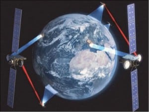
Like optical fiber on the Earth, the EDRS system, which is also referred to as SpaceDataHighway, will provide laser communications in Space with data rates of up to 1.8 Gigabits per second. The SpaceDataHighway will provide near-real time data transfer from Earth observation satellites, drones, or aircraft to Earth via geostationary communication satellites. It will be able to download larger volumes of image data faster and securely, helping to improve environmental and security monitoring, disaster response and crisis management.
EDRS-C is a dedicated satellite, unlike EDRS-A which is a hosted payload on the Eutelsat 9B satellite. EDRS-C will carry, among others, the EDRS payload which main component is the Laser Communication Terminal built by Airbus Defence and Space’s subsidiary, Tesat, enabling data transfer rates of up to 1.8Gbps.
The SpaceDataHighway will be operational early 2016 following the launch of the first node, EDRS-A, planned for this summer.
Get the latest Via Satellite news!
Subscribe Now