Government/Military

The Impact of Remote Sensing on Diplomacy
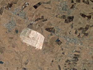
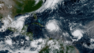
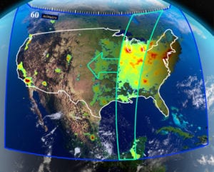
The remote sensing industry is set to explode over the next few years — but with eyes in the sky peering over nearly every country, how will this affect diplomatic affairs? From monitoring war threats to responding to major disasters, governments across the world are beginning to recognize that remote sensing can have a major...
Government/Military
First GPS 3 Satellite Ready for Launch
Ushering in a new era of advanced GPS technology, the U.S. Air Force declared the first Lockheed Martin-built GPS 3 satellite, GPS 3 SV01, “available for launch” on Oct. 10. The Air Force’s declaration is the final acceptance of GPS 3 SV01 prior to its expected 2018 launch. According to the Air Force, GPS 3...
Government/Military
GPS SV01 at Lockheed Martin's processing facility near Denver, Colorado. Photo: Lockheed Martin.
With 5G, European Commission Hopes to Avoid Repeat of 4G Rollout
The European Commission has begun work on a number of strategic 5G initiatives to ensure the European Union (EU) can remain economically competitive as the nascent technology develops. According to Nathalie Vandystadt, the European Commission’s spokesperson for digital economy and society, the organization’s main concern is preventing a repeat of Europe’s slow rollout of 4G...
Government/Military
EU flags in front of the European Commission. Photo: EUD.
Pakistan to Launch First Remote Sensing Satellite in 2018
Pakistan has publicly announced its plans to launch the country’s first ever optical remote sensing satellite, PRSS 1. On Oct. 5, the Pakistan Space and Upper Atmosphere Research Commission (Suparco) stated the satellite will fly into orbit sometime next year. Pakistan recently lofted its own communications satellite, Paksat 1 R, which is currently providing communication...
Government/Military
Lahore, Pakistan. Photo: Wikimedia.
Spaceflight to Launch U-Class Payloads for NASA
The NASA Kennedy Space Center (KSC) has awarded Spaceflight its first contract for launch and integration services. The multi-year contract covers launch services in 2018 for a maximum of 24 U-Class payloads, with options to provide launch services for up to 24 additional payloads in 2019 and 2020. The potential total contract value is more...
Government/Military
Australia’s CSIRO Inks Data Deal with SSTL
Surrey Satellite Technology Limited (SSTL) signed an agreement in Adelaide at the International Astronautical Congress (IAC) to provide Australia’s Commonwealth Scientific and Industrial Research Organization (CSIRO) a 10 percent share of the tasking and data acquisition capabilities from NovaSAR-S, a small radar satellite due for launch later this year. NovaSAR-S is a technology demonstration mission designed...
Government/Military
NovaSAR-S in the anechoic chamber for electromagnetic compatibility (EMC) testing and SAR payload testing. Photo: SSTL.
Australia to Finally Establish a National Space Agency
The Australian government used the opening of the International Astronautical Congress (IAC) in Adelaide, South Australia, to announce it would establish a national space agency. The announcement follows months of lobbying by the Space Industry Association of Australia (SIAA) and the South Australian government. Details of how the agency will be set up are yet...
Government/Military
Heads of space agencies, from left, NASA Acting Administrator Robert Lightfoot, Russian Federal Space Agency (Roscosmos) Head Igor Komarov, European Space Agency Director General Jan Woerner, China National Space Administration (CNSA) Secretary General Tian Yulong and Japan Aerospace Exploration Agency (JAXA) President Naoki Okumura at the International Astronautical Congress in South Australia. Photo: The Lead South Australia.
GOES 16 Proved Vital Asset This Hurricane Season
The 2017 Atlantic hurricane season has produced some of the most intense weather events seen in generations. Amidst the destruction, NOAA’s new GOES 16 weather satellite has proved to be a vital addition to weather forecasting infrastructure, as demonstrated when Puerto Rico lost its land-based weather forecasting radar ahead of Hurricane Maria. GOES 16, part...
Government/Military
GOES 16 captured this image of three Atlantic hurricanes simultaneously: Katia (L), Irma (M), and Jose (R). Photo: NOAA.
NASA's TEMPO Spectrometer Closer to Completion
The Tropospheric Emissions: Monitoring of Pollution (TEMPO) instrument, designed and built by Ball Aerospace for NASA, has completed spectrometer testing and verification, Ball Aerospace announced. Under its Earth System Science Pathfinder program, NASA selected TEMPO as the first Earth Venture-Instrument to provide hourly measurements of air quality across North America. This instrument will make precise measurements...
Government/Military
TEMPO’s measurements from GEO will create a dataset that improves prediction of air quality and climate forcing. Photo: NASA.
SSL to Validate Payload Cybersecurity for US Air Force
Innoflight has selected SSL to provide a high fidelity simulation environment for testing the security of hosted payloads on commercial satellites. The capability, which is being developed for the U.S. Air Force Space and Missile Systems Center (SMC) as part of its Secure IP Payload Accommodation Demonstration Project, will enable SMC to demonstrate cybersecure payload...
Government/Military
SSL hibay Facility