February 23, 2018
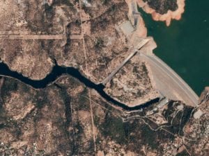
A unit in the Pentagon has put out a call for algorithms that can be used to analyze high-resolution satellite imagery. The contest, called the xView Detection Challenge, will award $100,000 to entrants who can develop more efficient ways to interpret geospatial data. Read more at Wired >>
Government/Military