Government/Military

General Dynamics to Restore, Maintain Satellite Simulator for US Navy
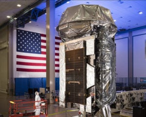
General Dynamics Mission Systems has received a contract from the U.S. Navy to restore and maintain a satellite system simulator for students at the Naval Postgraduate School, Spacecraft Research and Design Center / Adaptive Optics Center of Excellence. The simulator, a model of a Navy Fleet Satellite (FLTSAT) communications satellite, will help students hone their skills...
Government/Military
FleetSat simulator in a classroom-laboratory at the Naval Postgraduate School
Japan Places Eighth Reconnaissance Satellite in Orbit
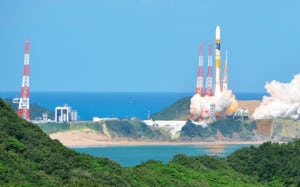
Japan has put another satellite into orbit to gather intelligence for national security purposes, as reported by NHK. An H2A rocket carrying the intelligence-gathering satellite lifted off from Tanegashima Space Center in Kagoshima, southern Japan, on Tuesday. It put the satellite into orbit some 20 minutes later, however, other launch details have not been disclosed...
Government/Military
H2A Tanegashima Space Center
Could the US Gain Access Brazil’s Alcantara Launch Base?
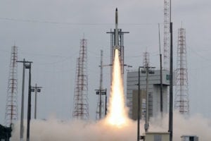
Government representatives from Brazil and the United States will resume negotiations that failed 15 years ago to allow the U.S. to use Brazil’s Alcantara Launch Base for its satellites. The decision to rekindle stalled talks followed a meeting between Brazil’s Foreign Minister Aloysio Nunes and U.S. Secretary of State Mike Pompeo on June 4. Unlike...
Government/Military
Brazil and the U.S. resume negotiations for access to the Alcantara Launch Base
More Satellites, Spectrum, Orbital Slots for SES O3b Constellation
The U.S. Federal Communications Commission (FCC) has granted authorization to SES to serve the United States market using a significantly expanded O3b fleet in the Medium Earth Orbit (MEO). The FCC grant opens additional frequencies to SES for use in its Non-Geostationary Orbit (NGSO) constellation and enables it to deploy O3b mPower satellites into inclined...
Connectivity
SES offices with antennas. Photo: SES
Marine Corps to be First in Deploying MUOS for the Battlefield
The U.S. Marine Corps is set to become the first service to widely deploy the Mobile User Objective System (MUOS) satellite communication capability for the battlefield as it looks to install the system across its radios by this fall. MUOS capabilities will be fielded to the Marines’ AN/PRC-117G radios through the fourth quarter of FY...
Government/Military
The fifth satellite of the U.S. Navy’s Mobile User Objective System (MUOS-5) at Lockheed Martin’s Sunnyvale, California satellite manufacturing facility
Harris Delivers Fifth GPS III Payload
Harris Corporation has provided Lockheed Martin with its fifth of 10 advanced navigation payloads contracted for the U.S. Air Force GPS III satellite program. The GPS III navigation payload features a Mission Data Unit (MDU) with a 70-percent digital design that links atomic clocks, radiation-hardened computers and powerful transmitters, enabling signals three times more accurate...
Government/Military
GPS III satellites in production at Lockheed Martin's GPS III Processing Facility near Denver
US DOD Partners with SES to Secure O3b MEO Services
SES Government Solutions (SES GS), a wholly owned subsidiary of SES, has signed a single-award Blanket Purchase Agreement (BPA) with the U.S. Department of Defense (DOD) for Medium Earth Orbit (MEO), low-latency, High Throughput Satellite (HTS) services. The total amount of all orders placed against the BPA cannot exceed $516.7 million over a five-year period...
Connectivity
Artistic rendering of O3b's MEO satellite constellation
Guatemala's Deadly Volcano as Seen via Satellite
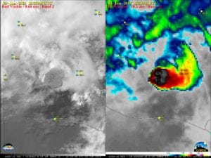
On Sunday, a volcano erupted in Guatemala killing at least 25 people and injuring hundreds, according to Reuters. The eruption of Volcan de Fuego, which translates to Volcano of Fire, is the most violent in the country in decades, and its second eruption this year. The lava has reached a 5-mile radius and spewed black...
Government/Military
GOES-16 “Red” Visible (0.64 µm, left) and “Clean” Infrared Window (10.3 µm, right) images, with hourly plots of surface reports. Source: CIMSS Satellite Blog
NOAA's Most Advanced Weather Satellite Captures Stunning Images
The first imagery from the National Oceanic and Atmospheric Administration’s (NOAA) GOES-17 Advanced Baseline Imager (ABI) has made its public debut. The imagery of the Western Hemisphere was created using two visible bands (blue and red) and one near-infrared “vegetation” band that are functional with the current cooling system performance. This debut comes as experts continue...
Government/Military
Full-disk snapshot of Earth’s Western Hemisphere captured by GOES-17 using the Advanced Baseline Imager